
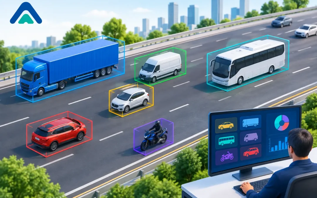
A detector that merely confirms a vehicle is present can keep a junction operating. A detector that identifies what kind of vehicle has arrived can help the authority operate the whole corridor better. Vehicle classification analysis turns passing traffic into evidence about demand, risk, capacity and network behaviour – without the disruption associated with road-embedded detection.
For highways teams, the distinction matters. A rising count may indicate more traffic, but it does not explain whether the additional demand comes from private cars, light commercial vehicles, buses, articulated lorries, motorcycles or cycles. Those movements place very different demands on road space, signal timing, kerbside access and pavement condition. Good classification data makes that difference visible.
What vehicle classification analysis reveals
Vehicle classification analysis assigns detected road users to meaningful groups, then reports how those groups move by time, location, direction and speed. Depending on the technology and application, classifications may distinguish cars, vans, rigid and articulated lorries, buses, motorcycles, bicycles and, in some deployments, pedestrians.
The value is not simply a larger dataset. It is the ability to interpret a traffic count in operational terms. If total flow remains stable while heavy goods vehicle movements increase, the implications for junction clearance, road safety and asset wear may be significant. If cycle volumes rise at a side-road crossing during the school run, a broad vehicle count will not expose the safety issue. Classification will.
This information supports decisions at several levels. At network level, it can reveal changing freight routes, rat-running patterns or the effect of a new development. At corridor level, it helps engineers understand peak direction demand and public transport delay. At an individual junction, it can inform detector placement, stage demand and the timing required for longer vehicles to clear safely.
Classification should always be assessed alongside volume, speed, occupancy and time of day. A high proportion of lorries at 03:00 has a different operational meaning from the same proportion during the morning peak. Context is what turns detection data into a credible basis for intervention.
Why totals alone can lead to poor decisions
Traditional traffic surveys often answer the first question: how many vehicles used this route? The limitation appears when a scheme depends on the type of road user, rather than the total number detected.
Consider a signal-controlled junction serving an industrial estate. A daily total may suggest moderate traffic demand, yet a short afternoon window could contain frequent articulated lorry movements. If detection and intergreen settings are based on average vehicle behaviour, the result may be inefficient operation, late braking or vehicles obstructing adjacent movements. Classification data identifies when the design vehicle is actually present and how often it influences the junction.
The same principle applies to bus priority. A general detector cannot distinguish a bus from the queue around it. Where priority is required, reliable vehicle identification helps target the call at the vehicle that needs it, rather than extending stages unnecessarily for all traffic.
There are trade-offs. Highly granular classes are useful only when the detection system can deliver them consistently in the prevailing site conditions. A specification that requests detailed body-type categories may add little value on a constrained approach where the operational decision is simply whether a large vehicle, bus or cycle is present. The classification scheme should match the decision it is intended to support.
Choosing the right detection approach
Above-ground radar, AI-powered video detection and wireless traffic sensors each offer strengths for classification-led applications. The appropriate choice depends on the site geometry, required classes, data purpose, communications availability and the need for real-time control versus periodic analysis.
Radar is particularly effective where all-weather vehicle detection, speed measurement and direction of travel are priorities. It can support vehicle classification through physical movement and profile characteristics, while avoiding the need to cut into the carriageway. This is valuable on strategic routes, high-speed approaches and locations where lane closures are difficult to obtain.
AI video detection can provide richer situational awareness. With a correctly positioned camera and well-defined detection zone, it can distinguish multiple road-user types, including cyclists and pedestrians, and observe movements that may be difficult to infer from a single-point detector. It is well suited to complex junctions, active travel schemes and urban sites where the interaction between modes matters.
Wireless sensors can provide a practical option for temporary studies, validation exercises or sites where a rapid deployment is needed. Their role is often to extend the availability of count and classification data without the civil works, reinstatement risk and maintenance burden of inductive loops.
No technology is automatically right for every location. Video performance depends on camera view, lighting, occlusion and scene complexity. Radar needs suitable mounting, coverage and configuration to separate relevant movements. A good site survey should establish what must be detected, where decisions will be made, and what could obstruct or distort the measurement.
Turning classifications into operational actions
The strongest programmes start with an operational question rather than a device specification. For example: are lorries using an unsuitable route? Are buses being delayed at a particular approach? Is a cycle crossing receiving adequate demand? Is traffic associated with a new development changing the peak profile?
Once that question is clear, the required classes, reporting intervals and accuracy expectations can be defined. Data should be segmented by direction and lane where the layout demands it. A two-way total on a multi-lane corridor may conceal a serious imbalance, while a single approach count at a junction can mask turning movements that cause the queue.
For signal operation, classification can refine how demand is treated. Longer or slower-moving vehicles may require different detection extension settings from cars. Buses can be identified for conditional priority. Cycles can receive a call without relying on a car-sized detection zone. The objective is not to create complexity for its own sake, but to make each intervention proportionate to the road user detected.
For network monitoring, recurring classification reports can expose trends that spot surveys miss. A month of data can show whether commercial vehicle activity is concentrated on certain weekdays, whether an alternative route is being used after a traffic regulation change, or whether weekend leisure cycling is creating a different demand pattern from weekday commuting.
For road safety teams, the combination of class and speed is especially useful. A small rise in vehicle volumes may be less material than a pattern of high approach speeds by motorcycles, or heavy vehicles travelling through a constrained environment at times when vulnerable road users are present. Classification does not replace collision investigation or site observation, but it provides stronger evidence for where to focus them.
Data quality is a design responsibility
Classification results are only as useful as the detection design, configuration and validation behind them. A detector must be installed with the relevant lanes, approach angles and detection zones in mind. If buses share a lane with general traffic, the system must be configured to distinguish them under queuing conditions. If a camera view is regularly obscured by foliage, street furniture or large vehicles, reported classes may not reflect what is happening on the road.
Validation should compare detector outputs with observed traffic during representative periods. This is not limited to the quiet commissioning window. Where possible, test in peak congestion, darkness, rain and the conditions most likely to challenge the site. It is also sensible to review exceptions rather than relying only on an overall accuracy figure. Misclassifying an occasional car may have little consequence for a broad count, while failing to identify buses at a priority junction could undermine the scheme objective.
Data governance matters too. Teams need consistent class definitions, timestamping and naming conventions so that records from different sites can be compared confidently. A vehicle data management platform can centralise those feeds, making it easier to review trends, investigate anomalies and share evidence across traffic, planning and road safety functions.
Building a proportionate specification
A proportionate specification states the outcome first: the road users to be identified, the movements or lanes to be covered, the data resolution required and whether information is needed in real time. It should then address physical constraints such as mounting opportunities, communications, power, maintenance access and the ability to install with minimal traffic management.
For many authorities, non-intrusive technology changes the delivery calculation. Avoiding carriageway cuts reduces installation disruption and removes a common point of failure associated with loop systems. It can also make future changes easier when lane layouts, signal strategies or active travel provision evolve.
C & T Technology supports this approach by combining above-ground detection technologies with the practical traffic engineering knowledge needed to apply them effectively. The useful question is not simply which detector has the longest feature list. It is which detection and classification arrangement will produce dependable evidence for the decision your network needs to make.
When classification is designed around a real operating problem, every detected movement becomes more than a count. It becomes a clearer indication of who is using the road, where pressure is building and what action is most likely to improve the outcome.